AZoQuantum speaks with Mark Stickells and Gretchen Benedix about their collaboration to create the most comprehensive map of Martian impact craters ever assembled. Using AI and one of Australia’s national supercomputing facilities, the team identified and catalogued 94 million craters across the Martian surface. Their work provides new insights into the planet’s geological history while highlighting the growing role of high-performance computing in advancing planetary science.
Could you briefly introduce yourselves and explain your roles at Curtin University and Pawsey, and how your collaboration led to this Mars-mapping project?
Mark: Mark Stickells AM, CEO, Pawsey Supercomputing Research Centre. As the Pawsey’s Chief Executive Officer, my role is to lead the strategic direction of the facility, ensuring we provide the high-performance computing, AI and data infrastructure needed to support large-scale scientific discovery for Australia and our research partners.
From Pawsey’s perspective, the collaboration with Curtin University reflects exactly why national research infrastructure exists.
The partnership emerged from the scale of the challenge. Mapping the surface of Mars involves processing vast amounts of high-resolution planetary data, a task that would take traditional computing an impractical amount of time. Curtin brings deep expertise in planetary science, while Pawsey contributes the computational capability and expertise needed to support work at this scale.
Importantly, it is not simply about providing access to Setonix, our flagship supercomputer, the largest and most energy-efficient in the Southern Hemisphere. A critical part of Pawsey’s model is the expertise that sits alongside the infrastructure. Our specialists work closely with research teams to optimise workflows and ensure applications can take full advantage of advanced computing environments.
By combining Curtin’s space expertise with Pawsey’s infrastructure and computational leadership, projects that might otherwise take years can be completed in days. That acceleration changes what is possible in research and allows scientists to pursue questions at a scale that would otherwise remain out of reach.
Gretchen: I am Prof Gretchen Benedix. I am currently the Associate Deputy Vice-Chancellor, Research at Curtin, where I contribute to the university's research strategy. This includes everything from the Research Training journey (Higher Degree by Research) to engaging with and showcasing the impact of research by Curtin.
Prior to this, I was a full-time teaching and research academic in the School of Earth and Planetary Sciences. My research has generally been focused on planetary science, in particular astrogeology, and finding the connections between the rocks from space that land here on Earth and where they originated in the Solar System. Most of my interactions with the Pawsey Supercomputing Research Centre occurred in my research role, starting as a mentor to a Pawsey intern and collaboration with various entities at Curtin.
The project to map the craters on the surface of Mars stemmed from a research question about how to use the geologic information we have about rocks from Mars here on Earth to better understand Mars. The collaboration came through interns and the CIDS.
What does it mean to map 94 million craters on Mars, and why is that such a major leap beyond previous crater catalogues?
Gretchen: Most of the crater catalogues that existed prior to our database were created by hand. This work has been limited by labour and image resolution. The labour required to denote and count craters is intensive, but not bad if the image resolution is poor (fig 1). However, spacecraft instrumentation has gotten to the point where we can image an entire planetary surface at a resolution that lets us see that the infamous “Face on Mars” was not a face, but a bunch of bumps and hills (fig 1).
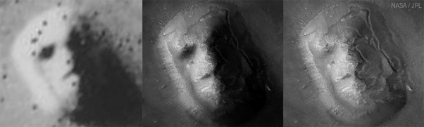
Figure 1. The “Face on Mars” captured by NASA’s Viking 1 orbiter in 1976 (left) and Mars Global Surveyor in 2001 (right). Image Credit: NASA
The crater catalogues allow researchers to unravel time on a planet's surface, based on the accumulation of craters over time. The calculation to convert the number of craters to time isn’t easy, and it’s not just about counting them, it’s about analysing their sizes as well.
To get an accurate clock, you need access to the smallest measurable units of time. In this analogy, those units correspond to the smallest craters, which are exponentially more numerous than the larger ones.
This is what makes this map meaningful. If we imagine the planet’s surface as a clock, the largest craters represent the hours, the medium-sized craters represent the minutes, and the smallest craters represent the seconds. To determine a precise time, you need the seconds, as they provide the detail and context necessary to accurately interpret the minutes and hours.
Keep the PDF of this interview for later
Could you describe the workflow from raw Mars imagery to the final crater catalogue, and where AI and high-performance computing were essential?
Gretchen: The workflow involved 2 steps: (1) Data (Image) Pre-processing and (2) application of a Crater Detection Algorithm.
The timing of this research was fortuitous, because a team at Caltech had just created a fully-controlled (normalising many image features to provide a seamless view) mosaic of the highest-resolution global data available for Mars, using the image repository from the Context Camera (CTX) on the Mars Reconnaissance Orbiter. The first step in data pre-processing was to download these images. The second step was a stereographic reprojection of the image to ensure accurate sizes and shapes of the craters. The third step involved downsampling of the images to ensure automatic detection of larger craters.
The Algorithm part of the workflow was reduced to 4 parts. The first part was to label the pre-processed images to create the training dataset. The labelled images were split into training and validation sets to optimise the algorithm. At the time, YOLO (You Only Look Once) v3 was the latest version available for object identification. The optimised version of the algorithm was then applied to the CTX mosaic. The final step in the process was to remove duplicates (craters that were double-counted because they were on image edges or in down-sampled images.
HPC was vital to analysing the dataset in a timely fashion. The resultant database of ~94M craters > 50m in diameter was accomplished in 24 hours, thanks to Pawsey. This could have been accomplished on a desktop and would still have taken less time than manually counting each crater. But the parallelisation and GPU speed were necessary to ensure the entire data set was processed simultaneously.
Which machine-learning or computer-vision approaches worked best for detecting craters at this scale, and what had to be adapted specifically for Mars?
Gretchen: After some trial and error, we found that a convolutional neural network (CNN) approach, using a supervised algorithm (YOLO v3) with a manually derived training dataset, produced the most reliable and reproducible results.
The main adaptation was to build the training dataset of relevant craters. The only available dataset at the time only had craters > 1km in diameter. These craters have a slightly different morphology to smaller ones, therefore we needed to label and validate a bespoke set of Mars-specific craters, between 50m and 1km in diameter. This was probably the most time-consuming part of the process.
What has this new crater map revealed about Mars’ history and evolution that earlier datasets could not show?
Gretchen: Initially, we looked at the data the same way it had previously been analysed, using histograms and crater-counting techniques to assess how well we reproduced the actual data. But 94M craters is a lot of data and a single histogram isn’t very visually pleasing. Because I have spent a lot of time looking at elemental maps of meteorites to understand variability in mineral composition, I suggested we look at the crater size distribution that way. This involved creating bins in latitude and longitude and determining the number of craters per bin. Looking at just the big craters doesn’t reveal too much, but looking at the very small craters was very revealing.
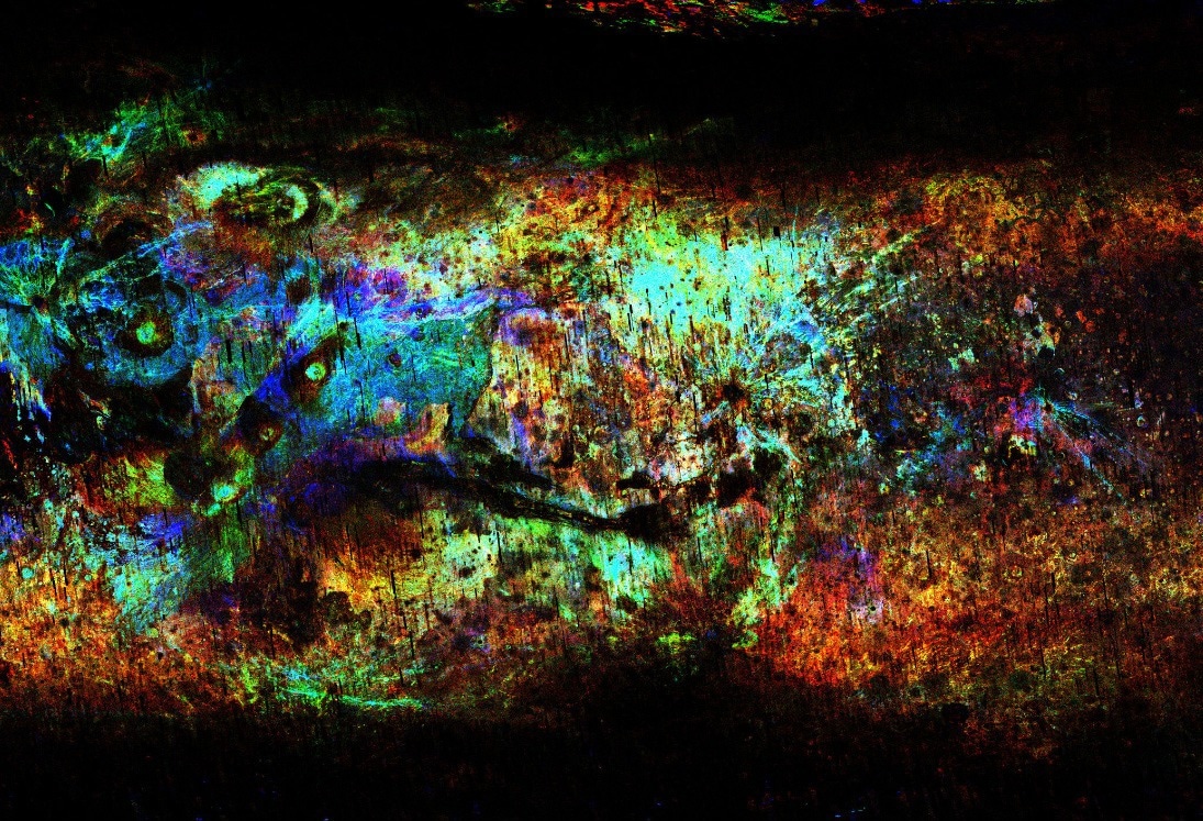
Full resolution version: https://hive.curtin.edu.au/research/CDA-94M-release/ Image Credit: Curtin University
This image is looking at craters between 50 and 300m in diameter but binned into 3 size ranges, where red is the larger end and blue is the smaller end. This lets us see the distribution of these small craters, revealing the structure of Mars as though we were looking at a map, but that structure is entirely based on the impact history. Using this dataset, we were able to pinpoint the youngest craters on Mars (those with rays emanating from the central point). This led to the identification of regions on Mars from which some meteorites originated.
How could this work support future Moon and Mars missions, particularly in areas like landing-site selection, navigation, or science planning?
Gretchen: So, this is the $1M question. There are a lot of scientific questions that could be answered with a map like this, things like understanding how the surface of Mars evolved, including where the water went and when it disappeared. That could help us build a better picture of why it disappeared in the first place.
But the map also gives us a bird’s-eye view of the distribution of navigation hazards across the Martian surface. The resolution is much better than what we’ve had before, although it’s still not at the level needed to create a literal road map of Mars. What it does allow us to do is narrow down areas of interest for higher-resolution mapping.
For example, it could help answer practical questions such as: Where is the best place to land? How far is that from the best location to set up a habitat? And what would be the best way to connect those two places? Those are the kinds of questions a map like this can help us start answering.
From both a technical and organisational perspective, what made it possible to run a project of this scale on Australia’s national supercomputing infrastructure?
Mark: Two things matter equally here. Technically, Setonix gives researchers like Gretchen a system built for exactly this kind of mixed workload: large-scale data processing, AI model training and inference, and visualisation, all on the same machine. Planetary science is not a single large simulation; it is an iterative pipeline where data, models and analysis feed each other. Having that capability co-located, with high-bandwidth interconnects and a software environment tuned by our specialists for each research domain, is what makes the scale practical rather than merely theoretical.
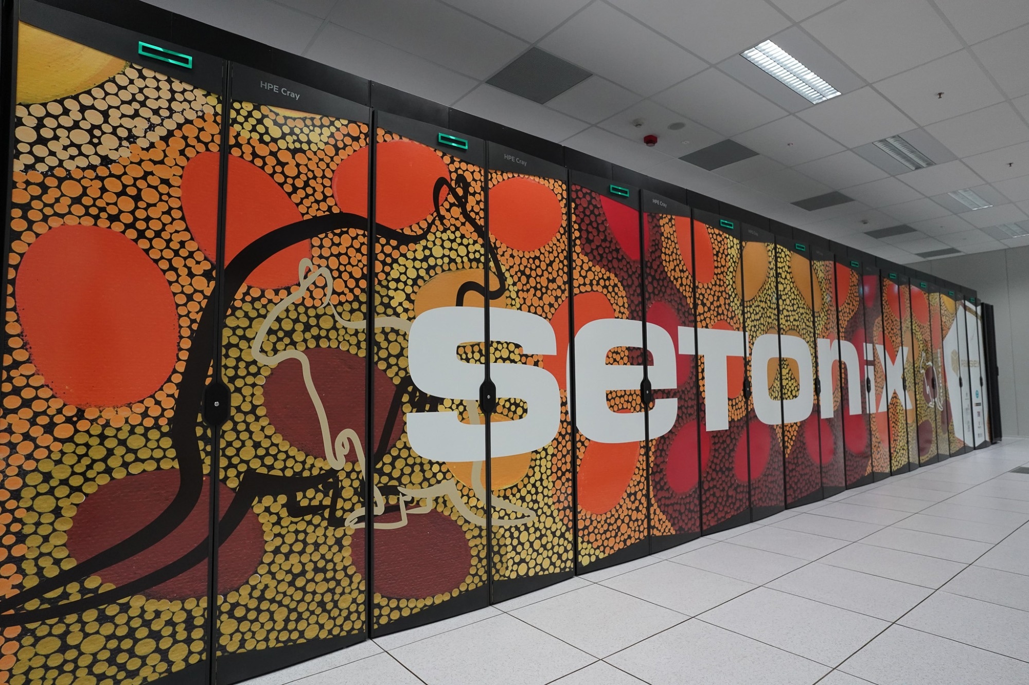
Image Credit: Pawsey
Organisationally, it works because Pawsey is a national facility, not a single institution’s resource. Curtin University is also a partner, which gives its researchers access to a special allocation scheme, alongside the other partners such as UWA, CSIRO and Western Australian government institutions. A Curtin researcher can access world-class infrastructure through a merit-based allocation, supported by staff who help translate a scientific problem into an efficient computational workflow. That partnership model (researchers bringing the science, and our teams supporting with computational expertise) is what allows ambitious projects to run while every research group grow their computational skills without having to build and maintain their own infrastructure. This project, in particular, started with an internship and grew into a full allocation, directly supported by a Pawsey team member.
Gretchen: The fact that the Pawsey Supercomputing Research Centre provided 25% of HPC time to geoscience-type projects was probably the main reason that this project was able to get off the ground. In addition, the Curtin Institute of Data Science's good relationship with, and understanding of, how best to utilise Pawsey was invaluable. I’m not an expert in HPC, so without all the help from Pawsey and CIDS, this project would never have happened.
From a national infrastructure perspective, what does this project show about the value of sovereign HPC and AI capability for research across different fields?
Mark: It shows that sovereign capability is foundational.
Time in science matters. Every research question carries a cost of delay. The same Setonix infrastructure that supports planetary discovery is also being used to find treatments for disease, design the next generation of sustainable materials, model our changing climate, and develop resilient crops. These questions need answers now, and the difference between a discovery arriving in five years versus fifteen is measured in lives, in livelihoods, and in whether a solution comes early enough to matter. Supercomputing, paired with the expertise to use it well, compresses that timeline, turning what would have been a decade of incremental work into a few years of accelerated discovery.
That is why sovereign supercomputing and AI infrastructure matters. Otherwise, the country will be delegating its climate modelling, food security, or health research to infrastructure it does not own or control. Owning the capability means Australian researchers can set their own agenda, experiment, move at their own pace, keep critical data onshore, and build the workforce that knows how to wield these systems.
This is what it means to treat HPC and AI as critical national digital infrastructure. The same sovereign foundation that lets Gretchen pursue curiosity-driven planetary science also underpins the discoveries that will define our health, our food, our climate and our economic resilience. A project like hers shows the breadth of what that foundation makes possible.
As AI becomes more important in scientific and operational decision-making, how are you addressing validation, uncertainty, and explainability in your models?
Mark: At Pawsey, we engage with this at a few levels.
The first is infrastructure. Rigorous validation of AI models, running ensembles, sensitivity analyses, and proper uncertainty quantification, is computationally demanding and supported by our HPC capacity at scale
The second is through our Pulse program (formerly known as Pawsey Uptake), where researchers gain access to dedicated Pawsey expertise to enhance performance, scalability, efficiency, and research capability using Pawsey infrastructure. That's where expert human judgement gets applied to the methods themselves, not just the outputs. In that sense, Pulse functions a bit like peer review for scientific software: interrogating what a model is actually doing, where its assumptions are, where it's being pushed beyond its validated parameters. That's exactly the kind of expert application and understanding of boundaries that responsible use of AI in science requires.
On explainability and uncertainty more broadly, validation is essential in responsible science and Pawsey's role is to ensure they have the compute, the expert support, and increasingly the methodological frameworks to do it well.
The frontier question is genuinely exciting. Quantum machine learning offers theoretical approaches to uncertainty quantification that classical computing struggles with, particularly in high-dimensional probability spaces, which is exactly the terrain of materials science and computational chemistry. The ability to better characterise what a model doesn't know is one of the more promising potential applications. Our Setonix-Q program, one of the world's first nationally funded, merit-based HPC-quantum integration platforms, puts us in a rare position to explore that.
What is the biggest bottleneck limiting the next generation of AI-driven planetary discovery, and why?
Mark: The immediate constraints are data readiness and human expertise. AI-driven discovery depends on large, well-curated, well-labelled datasets, and in many scientific fields that curation work is chronically underinvested relative to the modelling built on top of it. The other constraint is people: researchers who can bridge deep domain knowledge with computational methods are scarce, and building that workforce takes sustained, deliberate effort.
But beneath all of that sits a structural challenge that doesn't get enough attention: the cost of staying at the frontier is rising for every nation simultaneously. Global demand for advanced compute is climbing sharply, supply is constrained, and prices are following.
Sovereign capability in this environment depends on long-term, predictable funding commitments to avoid slipping generations behind, creating capability gaps that are harder and more expensive to close than to prevent.
There's also a subtler problem in where the hardware market itself is heading. The current investment wave is heavily oriented toward processors optimised for low-precision arithmetic, which is efficient for commercial workloads but poorly matched to the numerical demands of science.
Climate modelling, molecular chemistry, and planetary physics all depend on high-precision computation, where accuracy is not a preference but a condition for the result being trustworthy. If procurement follows the market uncritically, scientific infrastructure will be shaped by commercial priorities rather than scientific ones. The nations that get this right will invest in systems designed to serve both modes with equal seriousness.
Gretchen: The biggest bottleneck, in my opinion, is the availability of high-resolution imagery that can be used to both train and be the subject of analysis by AI and new algorithms. But that costs; we can’t analyse the entire surface of Mars at 30cm/pixel resolution because it takes forever to send the images. Currently, only very specific areas of Mars that are of interest are targeted for high-resolution imagery. If we had been able to analyse the images as they were being taken, the imagery data could have been reduced to two-dimensional table data, which could be transmitted much faster. Energy costs are high to send data back from other planetary orbits.
Read more about Martian coastlines here
About the Speakers
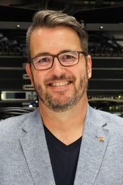
Mark is a research executive with more than 20 years’ experience working at a senior level in innovative research and business development roles in complex, multi-stakeholder environments. Through national and international programs and joint-ventures, Mark had successfully led initiatives to accelerate the impact of research, development and education programs for Australia’s key energy, mining and agricultural sectors.
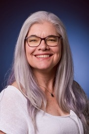
Professor Gretchen Benedix is an Australian planetary scientist and astrogeologist whose research centers on meteorites and the evolution of the solar system. Based at Curtin University’s Space Science and Technology Centre, she is recognized internationally for advancing methods to trace meteorite origins and for public engagement in planetary science
Disclaimer: The views expressed here are those of the interviewee and do not necessarily represent the views of AZoM.com Limited (T/A) AZoNetwork, the owner and operator of this website. This disclaimer forms part of the Terms and Conditions of use of this website.